Before Ballintubber Abbey was built, and even before Saint Patrick’s name became inseparable from the Reek, an ancient road is believed to have connected the royal heartland of Connacht with the mountain overlooking Clew Bay.
Its eastern starting point was Rathcroghan, near Tulsk in County Roscommon: the great royal and ceremonial landscape associated with the rulers of Connacht and the legendary Queen Medb. Its western destination was Cruachán Aigle, the mountain now called Croagh Patrick.
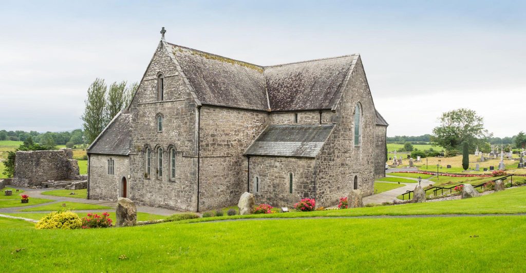
Today, Tóchar Phádraig is best known as the pilgrim path from Ballintubber Abbey towards the Reek, a journey generally described as about 35 kilometres. But despite its ancient past, the abbey belongs to a comparatively recent chapter in the story.
Ballintubber Abbey describes the route’s predecessor as a chariot road linking Rathcroghan, Aughagower and the mountain. Its precise age and original course remain uncertain, but the tradition places the Tóchar within an older landscape of kingship, travel and sacred places.
Along its course, ruined churches, holy wells, deserted homes and disappearing rivers preserve memories of medieval pilgrimage, religious persecution, famine and everyday life.
Before Patrick
The Irish word tóchar means a causeway, particularly a constructed passage across wet ground. In a landscape of bogs, rivers and marshy hollows, such routes allowed people, animals and goods to cross terrain that would otherwise have been difficult to negotiate.
The traditional connection with Rathcroghan gives this road a significance extending beyond Mayo. It links Croagh Patrick with the old political and ceremonial heartland of Connacht, recalling an approach to the mountain from the interior of the province.
Evidence of prehistoric activity survives along the wider route. At Boheh, south of Westport, an outcrop known as St Patrick’s Chair carries more than 250 prehistoric carvings, including cup marks, rings and keyhole forms. Heritage Ireland dates the rock art to around 3800 BC.
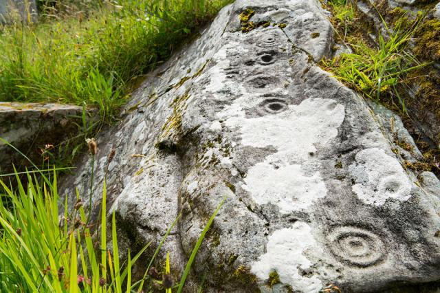
On particular evenings in April and August, the setting sun, viewed from Boheh, appears to touch the summit of Croagh Patrick and move down its northern slope. This is the phenomenon known as the “rolling sun”.
Whether the carvings were intended to mark that spectacle remains a matter of interpretation. Their antiquity, however, places human activity here thousands of years before Patrick. The later name, St Patrick’s Chair, adds a Christian association to an already ancient place.
A road of pilgrims
Christian tradition connected Patrick with the mountain, the wells and the settlements along the way. Over time, the road became known as Tóchar Phádraig — Patrick’s Causeway.
Ballintubber Abbey, founded in 1216, became an important stopping place. A hostel accommodated pilgrims, while a place remembered as Danchora provided facilities associated with washing and ritual cleansing. Its remains survive within the abbey grounds.
For medieval pilgrims, the journey involved more than reaching the summit. Churches, wells and devotional stations provided places to stop, pray and perform religious rounds.
Aughagower was an important centre along the way. The fields and settlements between Ballintubber and the Reek formed part of the pilgrimage itself, giving the journey a succession of stopping places before the final approach to the mountain.
Suppression and survival
The religious changes imposed under English rule brought upheaval to Ballintubber and the surrounding countryside.
According to the abbey’s history, its lands were confiscated in 1603. In 1653, Cromwellian soldiers burned its buildings, destroying the timber roof and much of the monastic accommodation. Parts of the church’s stone vaulting survived, and worship continued amid the damage.
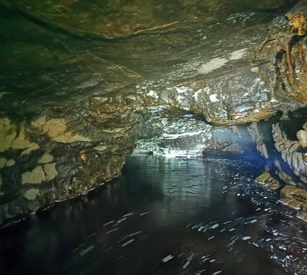
The pilgrimage road declined during the later sixteenth century and the following centuries of disruption. Religious practice continued in a countryside where isolated places could provide concealment. Local heritage accounts associate the Aille caves with secret Masses and describe watchmen stationed above to warn of approaching authorities. Pollatoomary Cave, part of the Aille underground system, is Ireland’s deepest explored underwater cave at a depth of 120 meters.
The Penal Laws introduced further restrictions. Their provisions changed over time, using registration, oaths, imprisonment and banishment to control Catholic clergy.
It would be inaccurate to suggest that every Catholic priest or religious service was illegal throughout the entire period. Nevertheless, enforcement could expose clergy, and the communities supporting them, to considerable danger.
Seán na Sagart and the Lake of the Heads
Few figures are remembered more darkly in this landscape than Seán na Sagart — John Mullowney, the priest hunter.
Mullowney was a real historical figure. Historian Michael M. O’Connor identifies a deposition dated 6 April 1715 in which he supplied information about Catholic clergy and religious activity.
That document provides evidence of his work as an informer. The more gruesome accounts of his career survive principally through oral history and folklore.
One tradition tells how he pretended to be dying and persuaded his sister to summon a priest. When the priest bent over him, Seán supposedly drew a concealed dagger and killed him.
Another describes his pursuit of a young priest who attended a funeral in disguise. The chase ended near Partry, where Seán was killed with his own weapon. Versions differ over the details, including who struck the fatal blow.
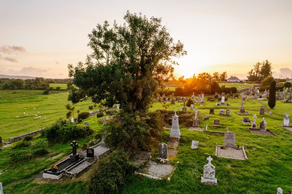
His burial also became the subject of legend. Local people were said to have dug up his body and thrown it into a lake, until a priest insisted that it be recovered and buried again. At Ballintubber, his reputed grave became associated with a tree remembered as Seán na Sagart’s Tree.
Near the Tóchar lies the lake remembered as Lough na gCeann — the Lake of the Heads. A story recorded in the National Folklore Collection says that Seán disposed of heads there after collecting his rewards.
This records a local tradition rather than proving that the killings happened as described. It nevertheless preserves the fear attached to his name and the way that fear became embedded in the landscape.
Beside the River Aille
Around the area known as “The Battlement”, the Tóchar encounters the River Aille and the ruined Killawullaun Mill.
In winter, heavy rain can transform this stretch. The river swells, streams fill and the surrounding ground becomes saturated. The need for constructed crossings and firm passages through the wet countryside becomes readily apparent.
The mill ruins recall another use of the river: its power to sustain local industry. Today, the abandoned building forms part of a landscape where working structures, religious sites and old paths survive beside one another.
Further along stands the ruined church of Teampleshaunaglasha, a place whose modest remains carry a substantial body of local tradition.
The church that people feared to disturb
Local heritage accounts describe Teampleshaunaglasha as a church unused since 1562. Its name is interpreted as the Church of John of the streams or channels.
A children’s burial ground, or cillín, surrounds the ruins. Such places were used for the burial of unbaptised infants and sometimes others excluded from conventional burial grounds.
The site is also remembered locally in connection with famine burials.
Stories warned against removing stones or objects from the church. One recorded account tells of men refusing to take its stones for another church building. A priest moved the first stone himself and, according to the tale, died within a week.
Whatever its literal truth, the story expressed a powerful conviction that the ruins and their burial ground should remain undisturbed.
Famine roads and deserted homes
A bohreen beneath overhanging trees leads towards the remains of a settlement said to have housed 26 families.
Local tradition tells of a mysterious woman who came at night to leave food for its starving inhabitants. The story preserves a memory of hunger and assistance in a place where the households themselves have disappeared.
Elsewhere, hardship survives in the names of roads. At Cullentragh, a section overlapping the Tóchar is remembered as a “Stirabout Road”, associated with people receiving oatmeal in return for work during the famine.
These places bring the history of the route close to ordinary lives: finding food, supporting a household and trying to remain on the land.
The old road passed through inhabited countryside. Its scattered ruins are reminders of communities that once worked the fields, used the lanes and knew the river crossings.
Where the river disappears
The Aille is one of the most striking natural features along the route.
In places, it flows openly through the countryside. Elsewhere, it disappears beneath limestone cliffs, following underground passages before emerging again.
The caves have attracted generations of explorers. Local heritage accounts record investigations during the 1970s and a much deeper exploration by Polish diver Artur Kozłowski in 2008.
Early reports also described blind fish in the underground waters. These should be treated as reported observations rather than established biological findings.
Nearby Pollhondra has its own darker tradition, concerning a man named Hondra who supposedly hid there after killing his wife.
As at many places along the Tóchar, the physical landscape and its stories have become closely intertwined. A cave offers concealment, a river vanishes, and local memory supplies an account of what happened there.
Patrick’s wells and the dancing hillock
A depression beside the route marks the place remembered as the Well of Stringle. According to local tradition, Patrick camped here over two Sundays and baptised people from the surrounding district.
The trail also passes the hillock known locally as Creggaun ’a Damhsa — the Hillock of the Dancing — where fairies were said to gather.
Such traditions reveal different ways of understanding the same countryside. A well is associated with Patrick; a neighbouring rise belongs to the fairies. Both give particular meaning to places that might otherwise seem unremarkable.
Near Coill an Bhaile, the route turns towards Aughagower. The ruined MacPhilbin castle stands prominently across the landscape, adding another reminder of the families and powers that once controlled this country.
Aughagower: a stopping place across the centuries
Aughagower brings together many of the themes encountered along the Tóchar.
Its round tower, ruined church and burial grounds reflect its importance as a religious centre. Its wells and devotional stations preserve traditions associated with Patrick.
Among them are Dabhach Phádraig, Patrick’s Vat; the Well of the Deacons; and Leaba Phádraig, Patrick’s Bed.
These are places associated with the saint through tradition. They should not all be described as surviving objects securely dated to his lifetime.
Local accounts describe pilgrims making rounds and reciting prayers at the stations. Walking, stopping and circling these places formed part of the religious journey before the pilgrimage continued towards the mountain.
Aughagower was therefore both a destination in its own right and a stage on a longer road.
The road recovered
The modern revival of the Tóchar dates to 1987, when the route from Ballintubber was restored. Its recovery depended on local effort and the cooperation of landowners whose fields it crosses.
More recently, interest has turned eastwards again. Rathcroghan Visitor Centre records a group walking a revived route of more than 170 kilometres from Rathcroghan to Croagh Patrick in 2024.
That modern itinerary does not establish every turn taken by ancient travellers, but it renews the connection between the mountain and the traditional royal heartland of Connacht.
The Tóchar’s significance lies in the many histories encountered along its course. Prehistoric carvings, medieval churches, stories of hunted priests, deserted homes and working farmland all form part of the journey.
Croagh Patrick gives the road its destination. The places and people remembered along the way give it its depth.
Reference
Croagh Patrick and the Islands of Clew Bay by Michael Cusack
Other stories of the Reek
When Pilgrims Climbed Croagh Patrick Through the Night
The Path up Ireland’s Holy Mountain
Croagh Patrick and Other Sacred Summits
The History and Mystery of Croagh Patrick
The Search for Gold on Croagh Patrick