Once home to hundreds of people, the little islands scattered across Westport Bay supported fishing families, farmers, boatmen and maritime traders. Their abandoned cottages, old field systems and surviving family names tell the story of communities whose lives were intimately connected with the sea.
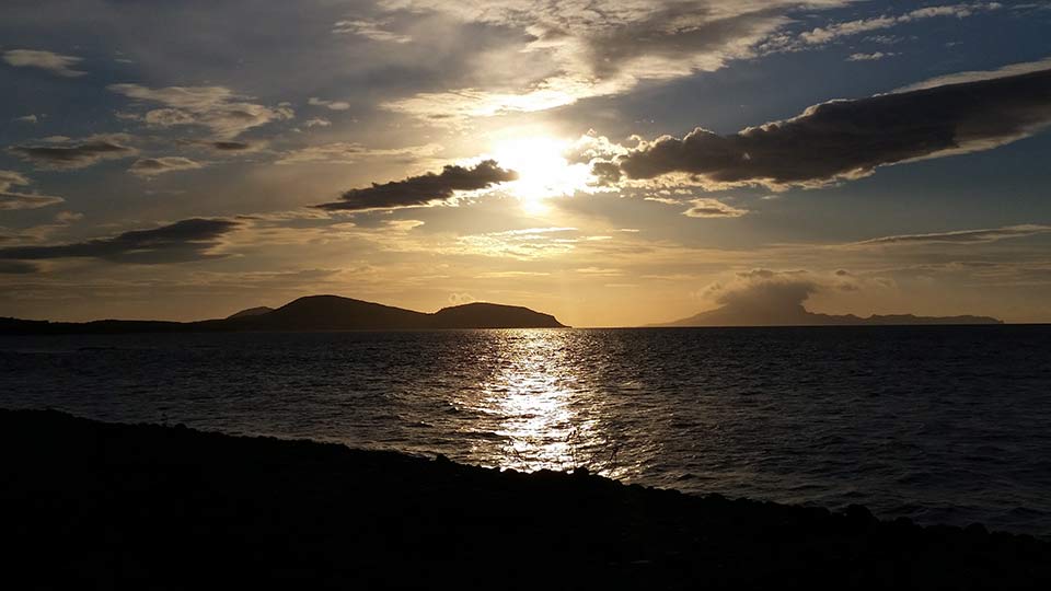
Look across Westport Bay today, from the shores of Murrisk or the slopes of Croagh Patrick, and the islands appear peaceful and largely untouched.
Some are covered in grass. Others have steep, eroding banks of glacial clay. A few contain renovated cottages or holiday homes. On many, the only evidence of former habitation is a ruined dwelling, the remains of a stone wall or the faint ridges of potatoes planted generations ago.
Yet less than two centuries ago, these islands supported thriving communities.
In 1841, Inishlyre had 113 inhabitants. Annagh East had 33, Illanataggart another 33, Inisheeny 36 and Inishraher 25. On Crovinish, more than twenty people lived on just 28 acres of land.
Some island communities survived well into the twentieth century. Others disappeared during or shortly after the Great Famine.
Today their populations have almost entirely vanished.
So who were these islanders, how did they survive, and where did everybody go?
A Bay That Was Once a Highway
Before the development of modern roads, the sea was the principal means of communication between many of the communities around Clew Bay.
Westport Bay stretches from the approaches around Inishgort Lighthouse towards Westport Quay, taking in the islands lying between the Rosmoney Peninsula and the southern shoreline extending westwards from Rosbeg towards Murrisk.
The bay’s geography is unusual. Its many small islands are predominantly the remnants of drumlins, elongated hills of glacial material left behind by the retreating ice sheets thousands of years ago.
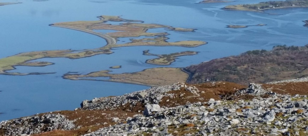
As sea levels rose, the low-lying land was flooded, leaving the higher ground isolated above the water.
Some islands are separated by deep channels and strong tidal races. Others are connected at low tide by shingle bars and mudflats.
For generations, the islanders made use of these natural crossings, moving livestock, collecting seaweed and transporting goods between neighbouring islands.
Boats were an everyday necessity.
They carried children to school, farmers to market, fishermen to their grounds and families to church or neighbouring settlements.
A journey that takes only minutes in a modern motorboat could be considerably more difficult under sail or oar, particularly during the Atlantic storms that regularly swept across the bay.
And the tides could be unforgiving.
In 1889, a thirty-year-old man named John Hanlon drowned in the narrow channel between Bartraw and Inishdaugh. He had crossed with three other men and their horses to collect seaweed. When a squall struck, the rising sea and strong current swept him from his horse.
His body was found on the opposite side of Inishdaugh.
It was one of many reminders that even apparently sheltered waters could be dangerous.
Westport’s Maritime Economy
Westport Quay developed as an important commercial harbour during the late eighteenth and nineteenth centuries.
The quay was established in 1780 and extended in 1837. At its commercial peak, Westport was a busy trading port, with a herring fleet operating from its waterfront.
The town’s connection with the wider Atlantic economy depended on the vessels, boatmen and pilots who worked the approaches to Clew Bay.
But Westport had a significant disadvantage.
The inner harbour was too shallow for some of the larger vessels arriving from overseas.
This made the natural deepwater anchorage at Inishlyre particularly valuable.
Larger ships could anchor there and transfer their cargoes to smaller boats, which carried the goods onwards to Westport Quay.
The island therefore became much more than a place where a few families farmed and fished. It served as an important link in the commercial life of the entire district.
The surrounding islands benefited from this maritime activity, whether through fishing, cargo handling, supplying vessels, piloting or transporting passengers and goods.
The herring industry was particularly significant.
Large shoals entered Clew Bay, sometimes reaching the waters around Inishlyre. Fishing vessels landed their catches, while barrels of fish were prepared for transport to markets elsewhere.
The dangers of this trade were illustrated in 1886 when the newly built, 26-ton cutter Spirit, owned by Patrick Hopkins, sank off Carrowmore Point on Clare Island.
The vessel had been overloaded with barrels of herring, and the excessive weight reportedly broke its back.
The story was preserved in the Hopkins family and later recounted by Gerardine Cusack in the foreword to Croagh Patrick and the Islands of Clew Bay.
Life on the Islands
For most island families, survival depended on several activities rather than a single occupation.
Fishing and small-scale farming were central to everyday life.
Potatoes were grown in narrow ridges still known as lazybeds, many of which are still visible on the islands today.
Cattle and sheep grazed the limited pastureland. Seaweed was gathered from the shore and used as fertiliser. Families also depended on seasonal work and whatever opportunities the maritime trade provided.
Houses were generally modest.
The 1911 census records several Westport Bay families living in thatched cottages containing just two rooms, often with large numbers of children.
Life was particularly difficult during periods of bad weather, when travel to the mainland could become impossible.
Yet the islanders also belonged to a closely connected society in which neighbouring families provided assistance when it was needed.
Gerardine Cusack recalled stories told by her father, Peter Hopkins, one of the last Westport pilots. He frequently stayed overnight with island families when storms prevented him from returning home. Her grandfather, an Admiralty pilot, was remembered for delivering bags of meal to occupied inner islands during the Famine.
Such recollections reveal another side of island life: cooperation, hospitality and a strong dependence on neighbours.
The Great Famine and the Beginning of the Decline
The Great Famine of the 1840s devastated communities throughout western Mayo.
For families occupying tiny islands, the failure of the potato crop was particularly serious.
Small holdings provided little opportunity to diversify agriculture, while dependence on boats made obtaining supplies difficult during bad weather.
The historical population records reveal the scale of the resulting decline.
Annagh East, for example, had 33 inhabitants in 1841. By 1861, the island was uninhabited.
Inisheeny had 36 inhabitants in 1841 but is recorded as uninhabited in the 1861 and 1881 population tables, although families were again living there by 1911.
Inishraher’s recorded population fell from 25 in 1841 to just three in 1861, before recovering later in the century.
Other communities proved more resilient.
Inishlyre, with 113 residents in 1841, still had 61 in 1861 and 67 in 1881.
Illanataggart fell from 33 residents in 1841 to 25 in 1861 and 24 in 1881.
These figures reveal something important. The Famine did not produce the same outcome on every island. Some communities disappeared, others survived with reduced populations, and a few experienced periods of recovery.
The longer process of depopulation continued for generations after the Famine had ended.
From Island to Mainland
The development of roads, railways and improved agricultural holdings gradually changed the circumstances of island life.
The Congested Districts Board, established in 1891, sought to address poverty and uneconomic smallholdings along Ireland’s western seaboard.
Through land purchase, redistribution, improvements to fisheries and the construction of infrastructure, it helped reshape rural life in counties such as Mayo.
For some island families, opportunities to obtain more workable holdings on the mainland reduced the need to remain on small and isolated plots.
Others left to seek employment in Irish towns, Britain or America.
The decline continued through the first half of the twentieth century and accelerated in many rural communities after the Second World War.
As young people departed, schools became difficult to sustain and the remaining households became increasingly isolated.
The disappearance of an island population was rarely a single event. More often it involved a gradual succession of departures until only one or two families remained. Eventually, the last permanent residents left, and the islands became places of occasional agricultural use, holiday occupation or complete abandonment.
The Islands of Westport Bay
Crovinish — The Fadden Family
Crovinish is a 28-acre island situated southeast of Inishlyre and northwest of Inishgowla South.
In 1841, it had a population of at least 22, according to the island description in Croagh Patrick and the Islands of Clew Bay.
By 1911, sixteen people remained, occupying three thatched cottages. Each cottage contained just two rooms. One was home to sixty-year-old Martin Fadden, his thirty-nine-year-old wife Mary and their eight children.
Ten people living in a two-room cottage illustrates the crowded conditions endured by some island families.
The population figures also show that Crovinish continued to support a community long after the Great Famine.
Today the island is no longer permanently inhabited, although its former houses and agricultural land provide evidence of the families who once lived there.
Inishlyre — The Forgotten Commercial Harbour
Inishlyre is one of the most historically important of all the inner Clew Bay islands.
Situated approximately two miles from Rosmoney, this 52-acre island possesses a sheltered natural harbour on its eastern side.
In 1841, it supported 113 inhabitants, making it one of the larger island communities in Westport Bay.
Its significance, however, extended far beyond its population.
During the nineteenth century, Inishlyre was an important anchorage for merchant vessels unable to enter Westport’s shallow harbour.
Cargoes were unloaded onto smaller boats and transported to the mainland.
Even large transatlantic vessels were said to have been capable of anchoring in its deepwater harbour.
Proposals were made to develop Inishlyre as a port of call for ocean-going ships, but the necessary railway connection was never constructed.
The island once had two public houses and a hotel, remarkable amenities for a community of its size.
These establishments almost certainly owed much of their business to the maritime traffic passing through the harbour.
Some island children were rowed to school on nearby Collan More, another reminder of the close relationships between the neighbouring island communities.
The Hopkins family also remembered three Gibbons families living on Inishlyre.
By 2011, only four permanent residents remained.
The harbour is still one of the most evocative places in Clew Bay, with its sheltered waters, old buildings and surviving maritime connections.
It is not difficult to imagine the scene when trading vessels lay at anchor and smaller boats moved between the island and Westport Quay.
Illanataggart — Priest’s Island
Illanataggart, meaning Priest’s Island, lies between Crovinish and the Rosmoney Peninsula.
In 1841, 33 people lived on this 29-acre island.
The population remained relatively substantial during the nineteenth century, with 25 residents in 1861 and 24 in 1881.
By 1911, however, only seven people remained, living in two houses.
Illanataggart is particularly interesting because its demographic decline appears to have occurred later than on several neighbouring islands.
While Annagh East and other small communities had already become uninhabited, Priest’s Island retained a settled population into the twentieth century.
A holiday home subsequently occupied part of the island, but its former permanent community disappeared.
Inisheeny — The Grady and Kelly Families
Inisheeny lies close to the southern shoreline of Westport Bay near Murrisk.
In 1841, the island had 36 inhabitants.
Its subsequent population history is unusual.
The historical appendix records no inhabitants in 1861 or 1881, yet by 1911 the island supported sixteen people.
Three two-room houses accommodated members of the Grady and Kelly families.
The apparent return of a settled population after an earlier period of abandonment deserves further investigation.
Were these descendants of the original island families, or did new tenants take over the land?
The surviving census records may eventually provide an answer.
The island is now uninhabited, but the Grady and Kelly names remain part of its history.
Gerardine Cusack also remembered the Higgins family of Inisheeny, providing another connection with the island’s twentieth-century inhabitants.
Inishraher — The Joyce and Jordan Families
Inishraher lies northeast of Inisheeny and south of Inishgowla South.
This 26-acre island has a cluster of buildings at its eastern end.
In 1841, it supported 25 inhabitants. Its population declined to three in 1861 before recovering to 21 in 1881. By 1911, eight people occupied two houses, each containing two rooms.
The families were named Joyce and Jordan, and their ages ranged from sixteen to seventy-four. This suggests a small but multi-generational community continuing into the twentieth century. Gerardine Cusack recalled Paddy Joyce, who kept a light shining on Inishraher.
The island later acquired a very different identity.
In 2005, it was designated a Maharishi Capital of the Global Country of World Peace and became associated with Transcendental Meditation retreats.
Thus, a place once occupied by farming and fishing families was transformed into a private spiritual retreat.
Annagh — The Disappeared Settlement
The Annagh Islands lie close to the Murrisk shoreline, protected from the open Atlantic by the Murrisk headland and the sand and shingle formations of Bartraw.
The group comprises Annagh East, Annagh Middle and Annagh West.
Annagh East is the largest, covering approximately 47 acres.
In 1841, 33 people lived there.
Following the Great Famine, the settlement disappeared. By 1861, the population records show no inhabitants.
Today little evidence of the former dwellings survives.
Annagh is therefore one of the clearest examples of an island community that vanished during the great demographic upheaval of the mid-nineteenth century.
It would be particularly interesting to identify the locations of its houses using nineteenth-century Ordnance Survey maps.
Dorinish — From Farming Families to John Lennon
Dorinish, near the mouth of Westport Bay, consists of Dorinish More and Dorinish Beg, connected by a natural shingle causeway.
The islands are now best known for their association with John Lennon of the Beatles.
Lennon purchased Dorinish in 1967 and later allowed Sid Rawle, sometimes known as the King of the Hippies, to establish a commune there.
For approximately two years, the islands became home to an alternative community.
Following Lennon’s death, the islands were sold by Yoko Ono, with the proceeds reportedly donated to a children’s hospital.
But Dorinish had a much older history.
The population records show thirteen residents in 1841, and later nineteenth-century occupation is also documented.
The remains of three small farms can still be found on the northeastern side of Dorinish More.
Long before John Lennon became associated with the island, families had attempted to make a living there from its limited agricultural land and the surrounding sea.
Its exposed western cliffs and isolation from the mainland make their experience particularly intriguing.
Inishgowla South
Inishgowla South lies between Inishraher and Crovinish.
It is a 28-acre island whose name distinguishes it from other islands called Inishgowla in Clew Bay.
The nineteenth-century population appendix records occupation during the period, including 39 inhabitants in 1861.
The island is no longer a permanent residential community, although a self-catering cottage was developed on its northern side.
The repeated use of the name Inishgowla for different islands makes the historical census records particularly difficult to interpret, and the populations need to be associated carefully with their respective locations.
Inishleague
Inishleague is a 13-acre island situated southwest of Inishraher.
The remains of a house survive near its northern shore, while old potato furrows provide evidence of agricultural cultivation.
Its southern side contains comparatively high cliffs.
Although the available material does not establish a reliable historical population, the surviving house and cultivation ridges indicate former human use.
The identity of its occupants remains a subject for further research.
Inishdaugh and Bartraw
Inishdaugh is a small island lying immediately offshore from Bartraw, at the western entrance to Westport Bay.
The channel separating them is deep, and its powerful tidal race has long been familiar to local boatmen.
Boats entering or leaving Westport Quay have used this passage for generations.
Inishdaugh is also associated with a local legend concerning treasure supposedly buried there by the Danes.
According to tradition, a hidden cave periodically reveals the location of the treasure, which is guarded by a supernatural figure.
The story claims that a Norwegian sea captain once employed local men to excavate the island but failed to find anything.
More firmly documented is the drowning of John Hanlon in 1889, while gathering seaweed with other men.
That incident illustrates both the everyday agricultural use of the islands and the danger of the tidal waters separating them.
Bartraw itself is connected to the mainland by a long sand and shingle formation, making it a tombolo rather than a completely detached island.
Cahernaran — The Lost Fort
Cahernaran is a small island close to Murrisk.
It is associated with the remains of an ancient stone fort, now destroyed.
Local tradition holds that a chieftain named Rann once lived there.
Although little is known about its later residential population, the former fort suggests that the island had a significance extending back far beyond the nineteenth-century farming settlements.
Illanroe and Inishimmel
Illanroe, or Red Island, lies near Rosbeg, several kilometres west of Westport.
It is a small, presently uninhabited island with no securely established residential history in the available material.
Inishimmel, another small island near Dorinish and Inishleague, is likewise uninhabited.
Both form part of the wider landscape of small islands, tidal channels and glacial deposits around Westport Bay.
Their histories are less well documented than those of the larger, formerly populated islands.
The Families Behind the Numbers
Historical population records tell us how many people lived on the islands, but family names give those figures a human identity.
By 1911, the Fadden family occupied one of the cottages on Crovinish.
The Grady and Kelly families lived on Inisheeny.
The Joyce and Jordan families occupied Inishraher.
The Gibbons families were remembered on Inishlyre, while the Higgins family had connections with Inisheeny.
These names are worth preserving.
They may provide a route towards discovering where the island families went after leaving their homes.
Some may have moved to Westport, Murrisk, Rosmoney or other nearby communities.
Others may have followed the familiar path of emigration to Britain or America.
Without tracing the individual families, their eventual destinations cannot be established with certainty.
But the census records provide a starting point for reconstructing their lives.
When the Sea Took Its Toll
The history of Westport Bay was not simply one of settlement and departure.
It was also shaped by maritime disasters.
The dangerous channels, submerged drumlins and powerful tidal currents presented constant hazards to the vessels entering and leaving the harbour.
In 1835, the schooner Uxbridge, travelling from Glasgow with coal and metal goods, grounded near Inishgort.
Boats from revenue cruisers and the coastguard station at Inishlyre went to her assistance and succeeded in rescuing the crew.
In 1860, the Glasgow vessel Leguan, carrying rum, sugar and molasses from Grenada, encountered a gale in Clew Bay.
Three pilot boats went out to assist her. The boats were lost, although their crews survived, and the vessel was eventually destroyed by fire.
In 1899, the wooden sloop Flora was at anchor at Inishlyre when she was struck by the schooner Kate during a severe gale.
She became a total loss.
In 1904, the fishing smack Pearl burned in Inishlyre harbour.
In 1928, the 200-ton ketch Charles Stewart Parnell, used to supply lighthouses with coal and provisions, caught fire and sank near Inishlyre.
Its wreck still lies beneath the waters of the bay.
Perhaps the most tragic episode occurred in June 1894, when a boat carrying seasonal workers from Achill capsized near Westport Quay.
The passengers were travelling to meet the steamer SS Elm on their way to work in the Scottish harvest fields.
As the vessel approached the steamer, passengers moved towards one side and it overturned.
Thirty-two deaths are recorded in the wrecks chapter of Croagh Patrick and the Islands of Clew Bay.
The disaster devastated families across Achill and remains one of the most tragic events in the maritime history of Clew Bay.
Roman Island — Where the Islands Met the Town
At the eastern end of Westport Bay lies Roman Island, known locally as The Point.
Unlike the more remote islands, Roman Island became closely associated with the growth of Westport Quay.
The harbour developed along its northern side, and the island’s western end is said to contain substantial deposits of ballast discharged from visiting ships.
In earlier years, the Bath Hotel stood here.
The island later became home to the Westport Heritage Centre and Westport Sailing Club.
Roman Island represents the point at which the world of the small island communities met the commercial activities of the town.
For generations, boats from the surrounding islands carried people and goods towards this waterfront.
Fishermen, pilots, merchants, emigrants and seasonal workers passed through Westport Quay.
It was both a place of arrival and a place of departure.
What Remains
The islands of Westport Bay did not simply become empty overnight.
Their communities declined over generations.
Some families left during the Famine. Others remained for decades, continuing to farm, fish and raise children on small holdings surrounded by the sea.
As opportunities improved elsewhere, younger generations increasingly moved away.
Eventually, the remaining households became too few to sustain permanent communities.
Today the evidence of that former world survives in scattered ruins, old field boundaries, potato ridges, landing places and the occasional abandoned cottage.
The names survive too.
Fadden. Gibbons. Grady. Kelly. Joyce. Jordan. Higgins.
They belonged to people who raised families, worked the land, fished the waters of Clew Bay and travelled between the islands long before the area became a popular tourist destination.
The islands were not always silent.
They once echoed with children’s voices, the sounds of farming and fishing, boats being hauled ashore and conversations between neighbours.
Their disappearance is one of the quieter chapters of Mayo’s history.
And it deserves to be remembered.
Does Your Family Have a Westport Bay Island Connection?
We are interested in hearing from anyone whose parents, grandparents or earlier ancestors lived on the islands of Westport Bay.
Particularly welcome are old photographs, family histories, memories of island schools, fishing boats, former cottages, house names and recollections of travelling between the islands and Westport Quay.
If your family has a connection with Inishlyre, Crovinish, Inisheeny, Inishraher, Illanataggart, Annagh, Dorinish or any of the smaller islands, we would be delighted to hear from you.
Contact: [email protected]
Next Post – Where did the people of Newport Bay’s Islands go?